|
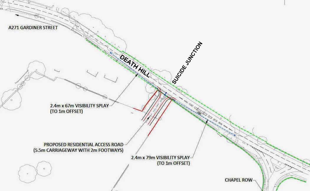
19 VISIBILITY SPLAY - WD/2015/0090/MAO
Please use our A-Z INDEX to navigate this site
|
|
THE GRIM REAPER STANDS IN WAITING - What visibility splay? Have East Sussex County Council gone mad! The hedge on the left prevents any car coming from the proposed site entrance, from seeing to the right. From this one easily obtained picture it is obvious that the approval of this entrance for up to 70 dwellings is a rubber stamp job by ESCC Highways, allegedly in respect of a brown envelope back hander - not taking into account the incline and entrances from the other side of the hill. See below.
The proposed new entrance is the other side of a hill that has had a few accidents, so introducing a dangerous situation that could affect hundreds of travelers on the A271. Drivers coming from Windmill Hill will see the nose of a vehicle and may be forced to brake hard, when the driver seeking to exit Lime Cross, is forced to put the nose of his vehicle in the path of oncoming traffic. Approval of this application without any real investigation of the facts is suspect to say the least. The way Wealden got around that is to put the onus on the developer to prove their case - but in fact, in making a grant tends to egg on a developer, figures can sometimes be massaged. This was formerly application WD/2014/2663/MAO, under the name Timothy Watson. It seems as though they don't mind a few fatalities if they can generate some money in a pot. See some of the examples of good design below - and compare. Good for the undertakes also, and reduces population growth as well.
WD/2015/0090/MAO - CONDITION 19 - ENTRANCE A271 VISIBILITY SPLAY
19. The access shall not be used until the appropriate visibility splays are provided in each
direction (2.4m x 105m to the west and 2.4m x 122m to the east). The visibility splays
should be cleared of all obstructions exceeding 600 mm in height and kept clear
thereafter. HW16
HIGHWAYS - EAST SUSSEX COUNTY COUNCIL
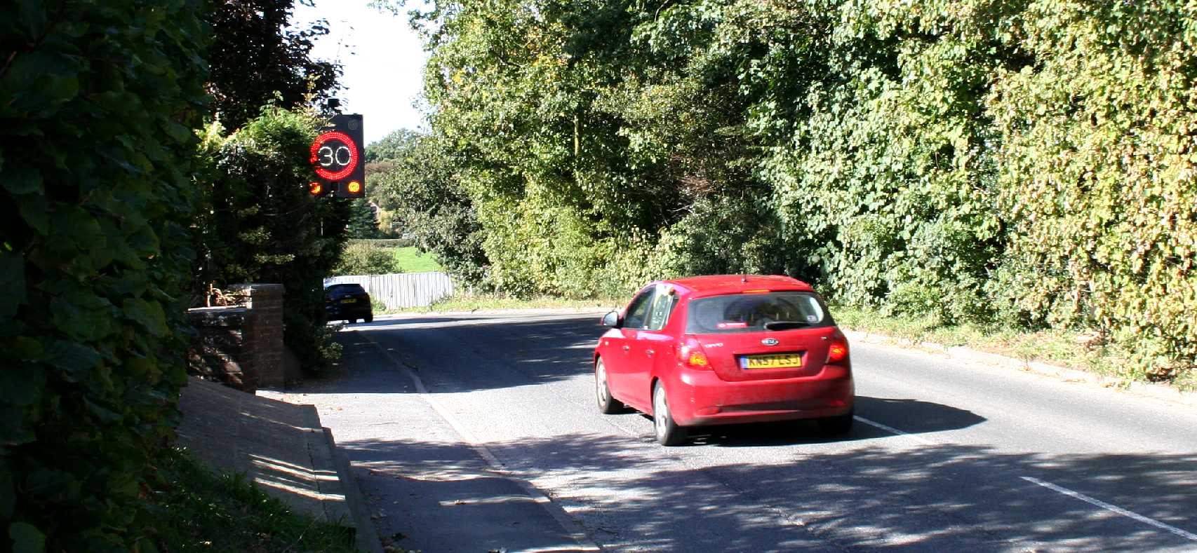
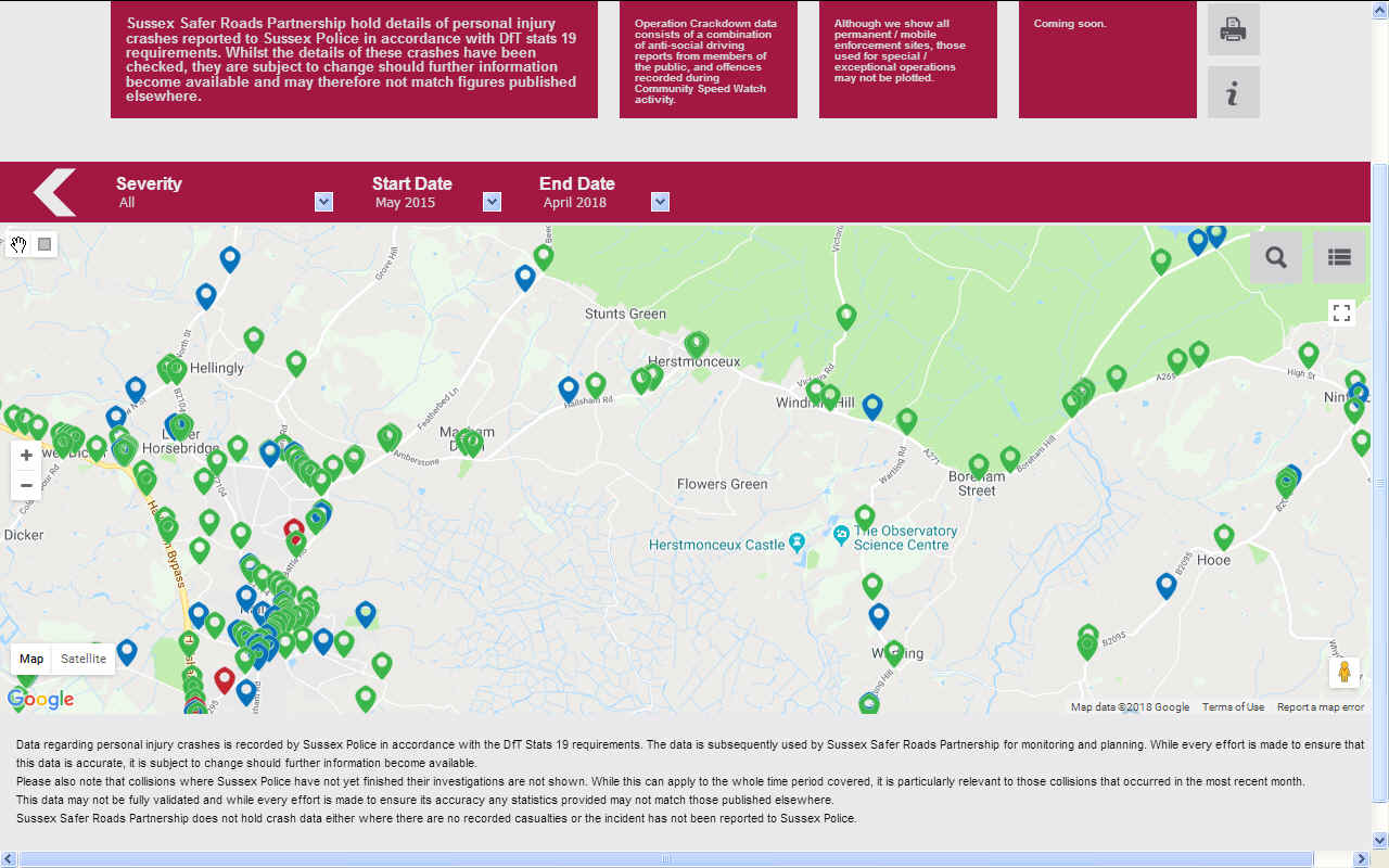
The stretch or road fronting the site is subject to a 30mph speed limit; however a speed survey has been undertaken close to the proposed access point in order to determine actual vehicle speeds. The results of this survey indicate an 85th % tile vehicle speeds of 40.6mph for vehicles approaching the site access from the north-west and 44.9mph for those approaching from the south-east.
Although
the sightlines shown on the submitted plan fall short of the requirements based on my own calculations I am satisfied that appropriate visibility splays can be provided either side of the site access.
COMMENT: But how Benjamin? How can these issues be addressed fully and are you aware of Corporate Manslaughter imposing a statutory duty of care in this regard?
WONDERFUL - Now that is what we call a visibility splay. It's the sort of entrance with a high degree of visibility in both directions that nobody could complain about. No favours for mates here, just good planning and the application of sustainable practices - apart that is for the fact that the road itself is substandard considering the extra traffic that is is being required to carry from planning consents along its length. Copyright photograph © Lime Park Heritage Trust. All rights reserved.
ACTUAL SPEED - Regardless of the speed limits, it is the actual average recorded speed past a location on which splay design should be based. Copyright photograph © Lime Park Heritage Trust. All rights reserved.
PARKING RESTRICTIONS - You will always get some plonker parking in a manner that upsets the view for other motorists. If there are repeat offenders who keep on parking inappropriately, the only way to dissuade them is to apply white lines and patrol the area regularly to hand out parking tickets. Copyright photograph © Lime Park Heritage Trust. All rights reserved.
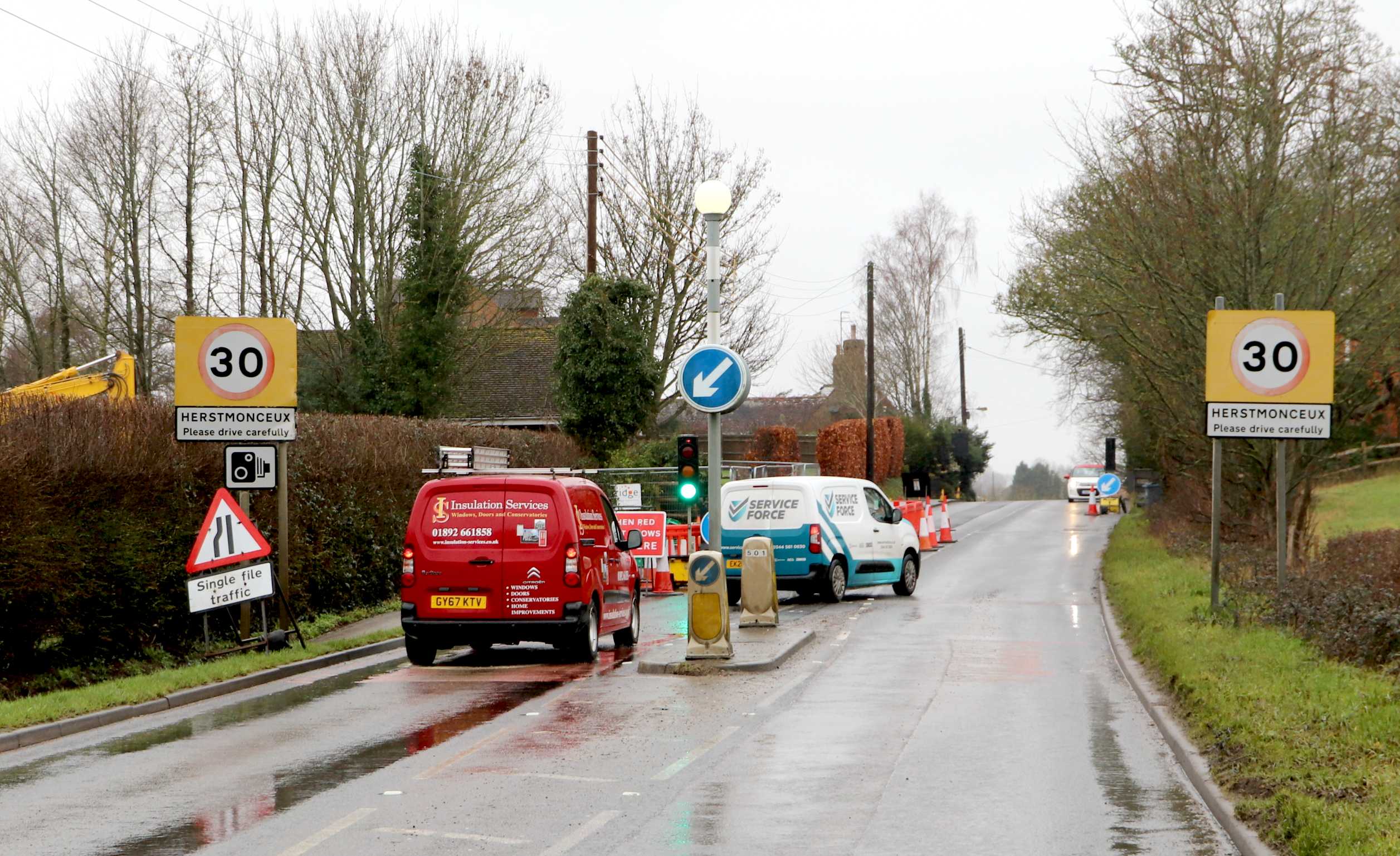
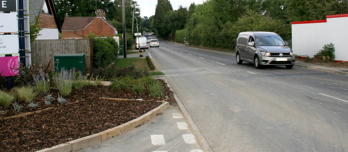
NICE VIEW - Once again the visibility from this site is superb. Pity they cannot match that with the development in Herstmonceux. Not to worry though, with a few brown envelopes a developer can get away with murder. Literally. it's called corporate manslaughter. Overloading A class roads with too much traffic from clusters of houses that these roads were not designed to take, is sure to lead to potholes and other road maintenance issues. Further along this road the surface in seriously deteriorating. We wonder then if this is the sustainable development that the United Nations are looking for, or the mad rush to build houses due to the fact that planning departments didn't and don't plan ahead. We call this Pothole Politics. Copyright photograph © Lime Park Heritage Trust. All rights reserved.
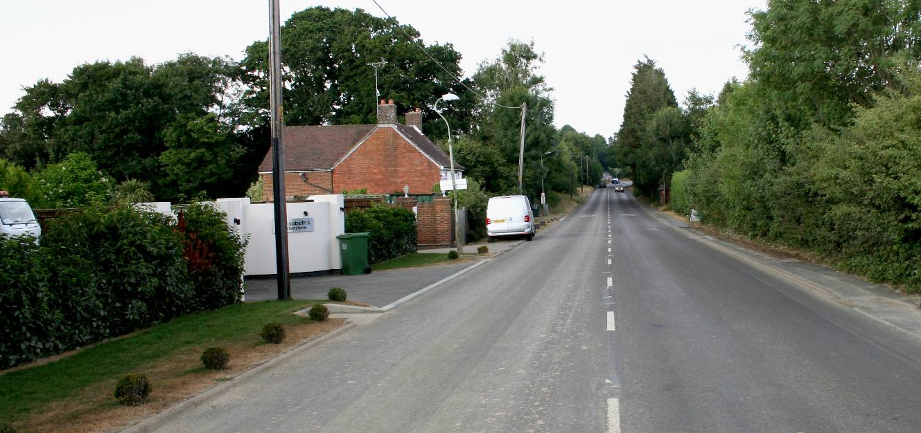
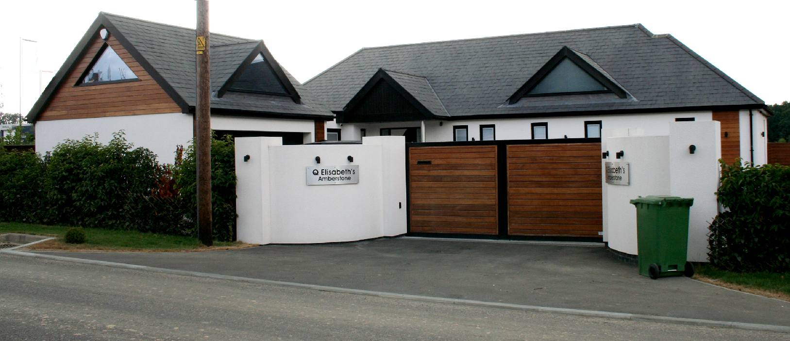
LOVELY - Not only is the visibility splay excellent on this single unit development, but the house is also a little gem of a design. Well done Elizabeth. The only problem being the noise from traffic at night. Presumably this is why the property was up for sale in 2020. Copyright photograph © Lime Park Heritage Trust. All rights reserved.
LATIMER, THAKEHAM, CLARION (GROUP) - LIST OF PERSONS INVOLVED IN THE DEVELOPMENT
Peter Rawlinson - Gleeson Strategic Land Ben Rainbow - Arboricultural & Biodiversity Officer Steve Tuhey - Managing Director, Thakeham Client Richard White, Director of Land and Planning at Latimer & Clarion Housing Group
Latimer Developments - Previously: William Sutton Developments Limited
Christopher John Hatfield Ruth Margaret Cooke David Simon Fordham Austen Barry Reid Rupert Owen Sebag-Montefiore Mark Christopher Rogers David Anthony Lewis Michelle Reynolds
Southern Water - Nick Claxton Team Manager – Flood Risk Management & Revai Kinsella, Principal Drainage Officer.
WD/2015/0090/ HERSTMONCEUX VILLAGE CONDITIONS A - Z INDEX
BROW OF A HILL - The cumulative effect of loading a road with additional entrances increases the risk of accidents. This is the peak of the hill leading to the speed warning sign, where most motorists drive through faster than the 30 mph limit. you can see another new entrance on the right hand side of the road just below the brow of the hill. You can imagine the carnage if several drivers are trying to exit onto this road from different sides of the hill - especially so where the visibility splay is below standard. Copyright photograph © Lime Park Heritage Trust. All rights reserved.
WD/2015/0090/MAO - GLEESON DEVELOPMENTS LTD
This application is not only contrary to Wealden's Local Plan, but is considered by many to be downright dangerous. The A271 is a narrow country road that is already overloaded - with many traffic jams in the village high street causing motorists serious delays on occasion. The increase in traffic from a dense residential development at this location is nothing short of madness.
LINKS & REFERENCE
https://thakeham-client.com/ http://www.clarionhg.com/news-research/2018/march/latimer-to-deliver-70-new-homes-in-herstmonceux/ https://www.gov.uk/ http://www.english-heritage.org.uk/
HOME | A-Z INDEX | MEMBERS | MPS | OFFICERS
|