|
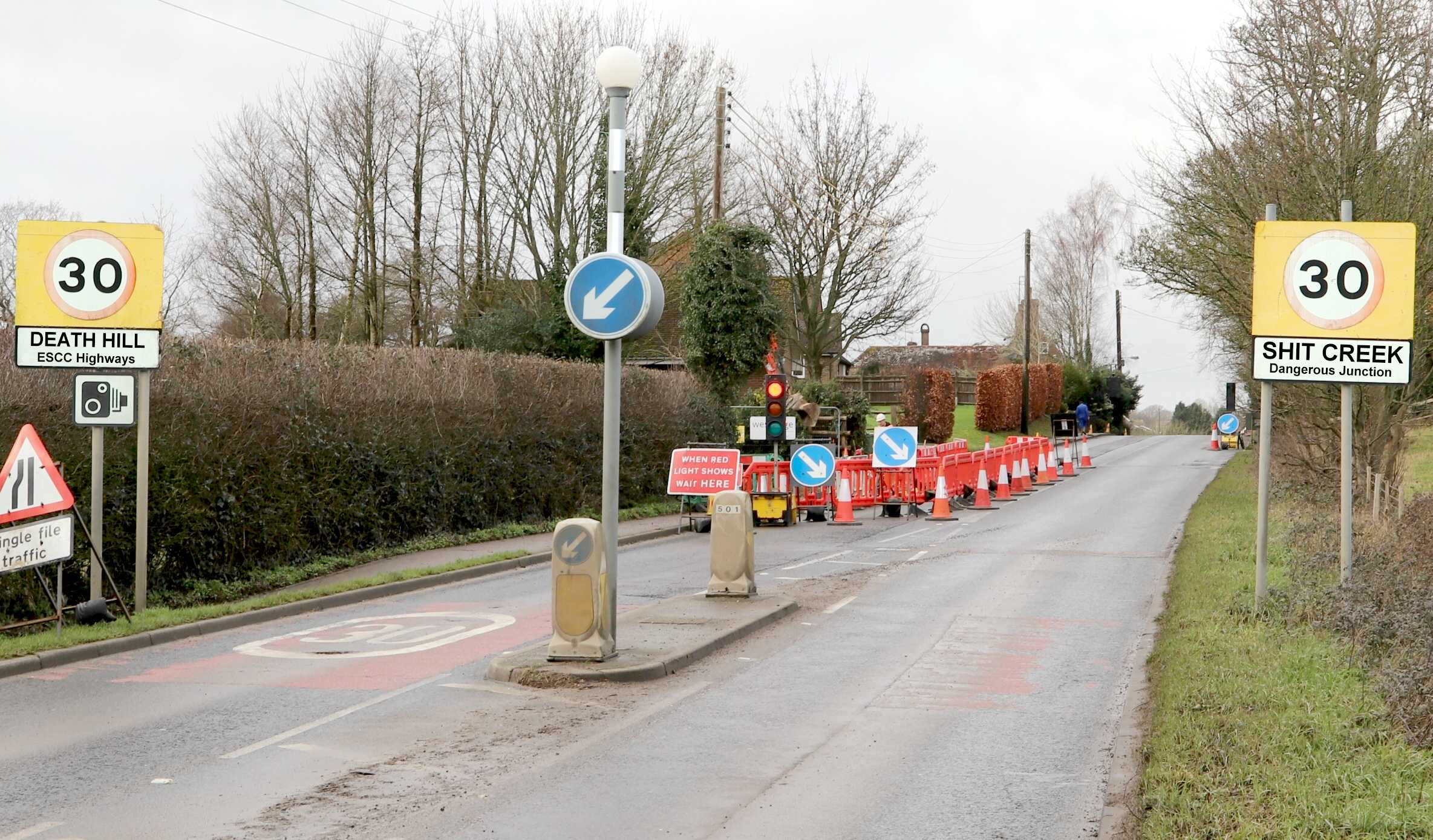
SUICIDE JUNCTION
Please use our A-Z INDEX to navigate this site
|
|
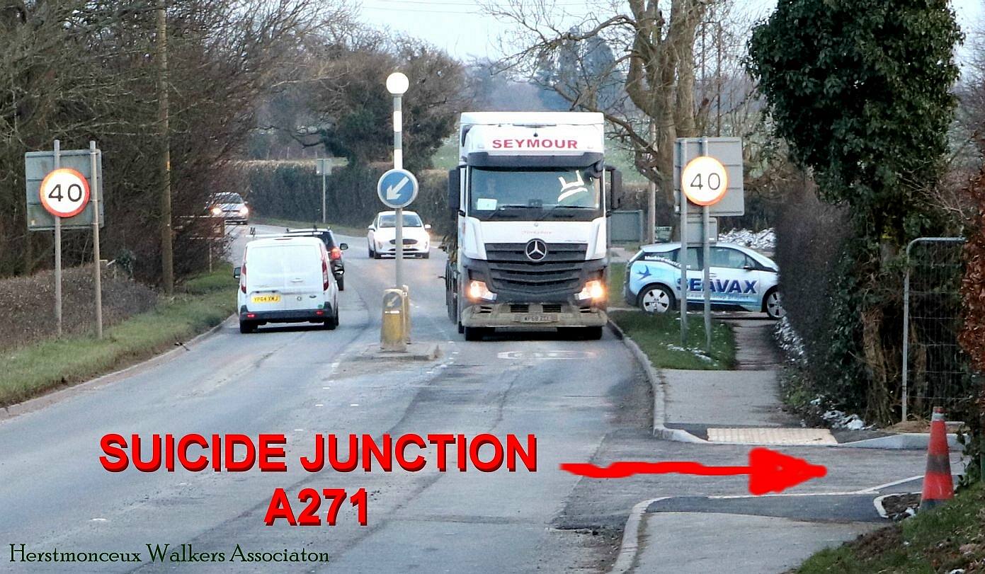
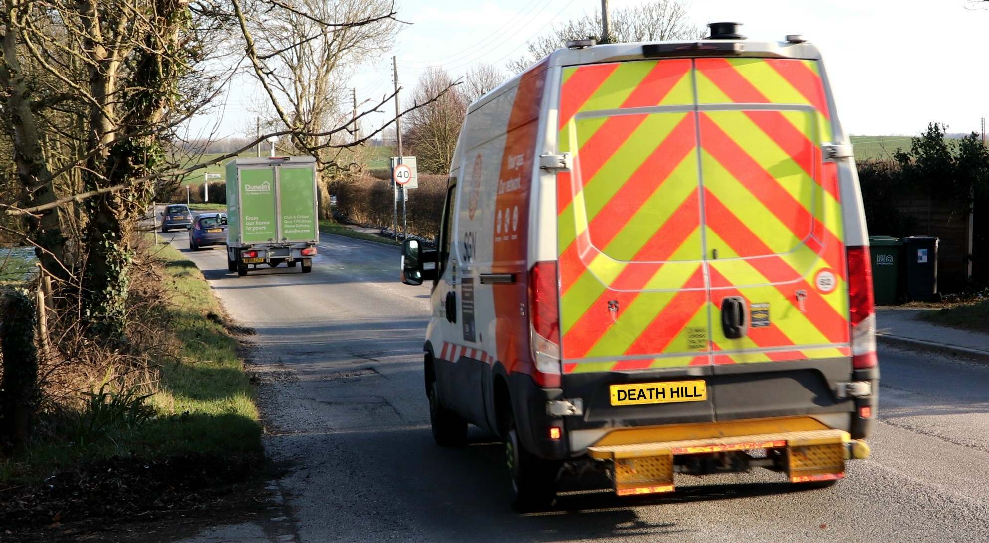
FEB 11 2021 - A large Mercedes truck approaches Suicide Junction, passing by the football grounds, into the 30 mph speed zone, up Death Hill. The average speed at approach is well over 40 mph in both directions.
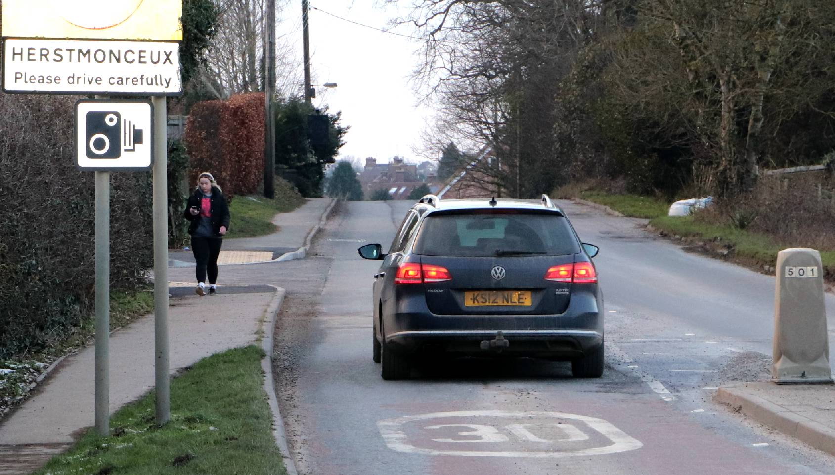
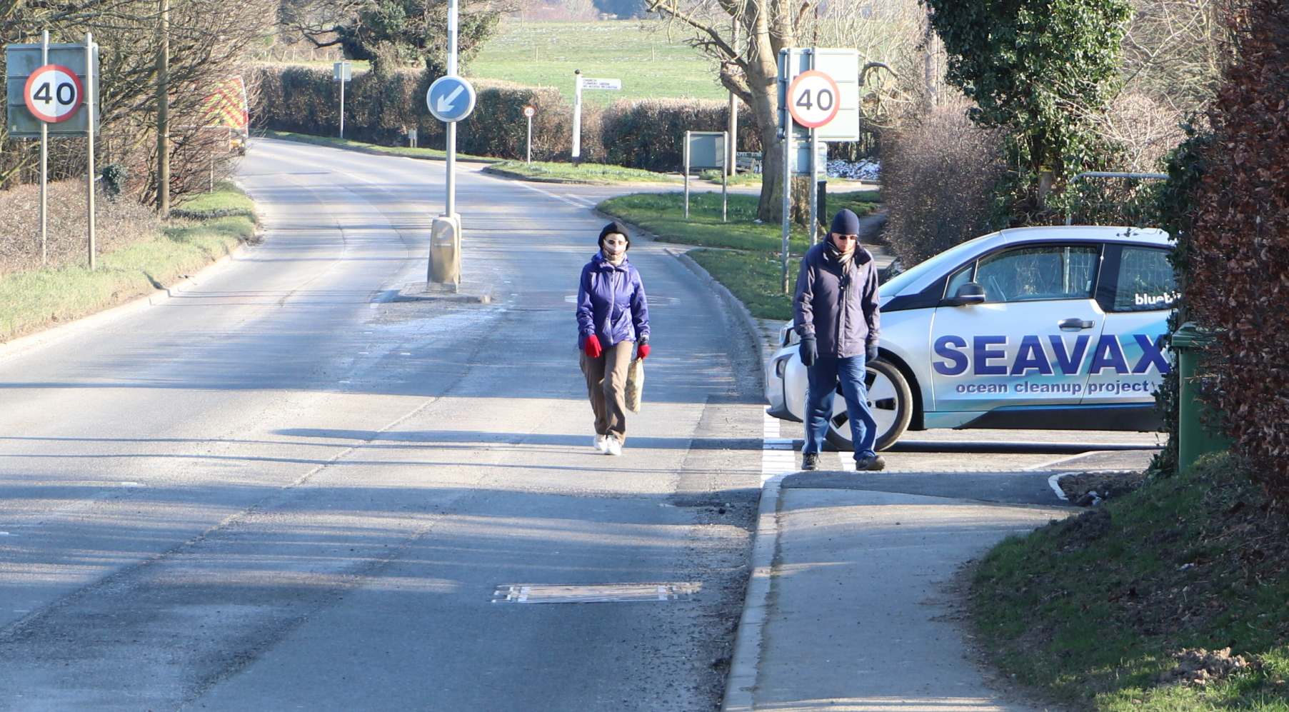
WALKERS - The pavement on the right as you approach Herstmonceux village is used by quite a high number of residents, as a passage to Windmill Hill, another area with new builds, creating more traffic. Dog walkers also use this route. Drivers are braking as they pass the speed signs, where they approach the brow of Death Hill, the location of a number of accidents on the west face.
LIMITED VISIBILITY - Having just navigated the brow of the hill leading out of the village, a driver behind a largish vehicle cannot see Suicide Junction or the pedestrians along the pavement.
A271 - Large trucks carry goods to and from Tonbrige and Hastings, Lewes and Brighton. The A271 meets the A22 at the Boship Roundabout, also forking off to Crowborough, the former Council offices, a vipers nest of legal dirty dealings in the past involving Vic Scarpa, Christine Nuttal, David Phillips and the present Chief Executive, Trevor Scott.
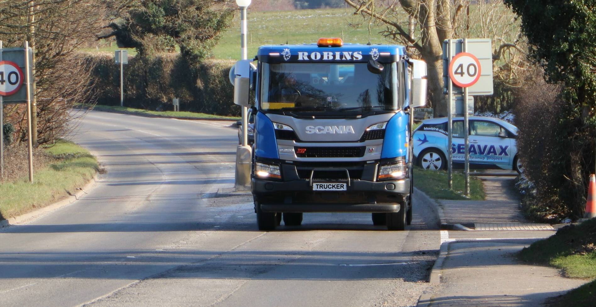
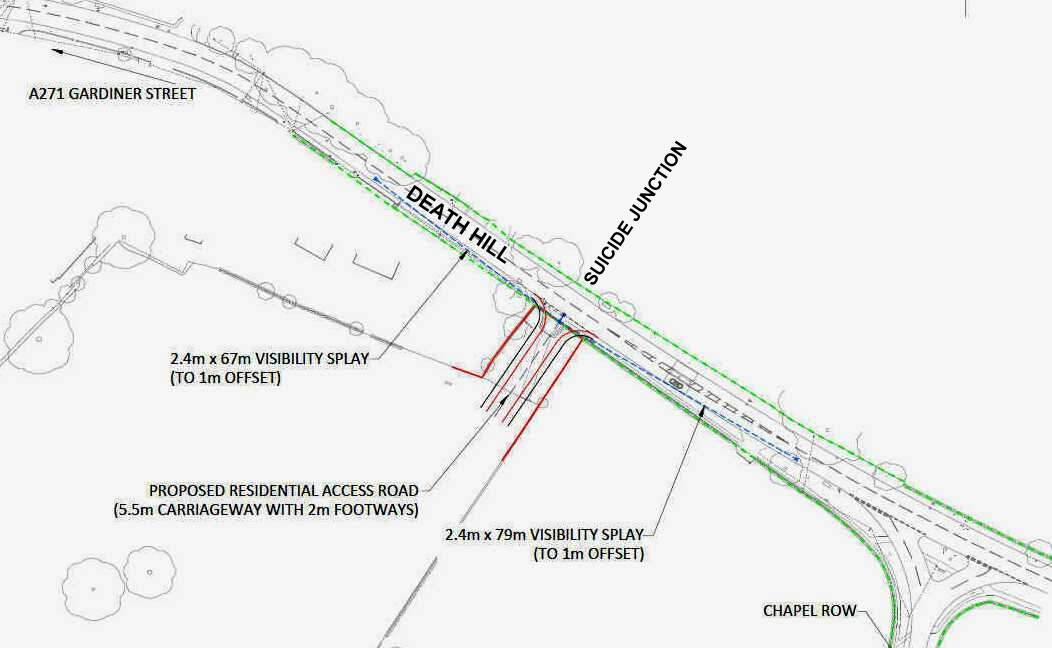
VISIBILITY SPLAY - Deficiencies in the specification of what locals are calling 'Suicide Junction,' only really become apparent when a driver seeks to exit Shit Avenue and join the A271 at Death Hill. Walkers using the pavement are likely to skirt around vehicles, straying into the path of following traffic. Did Ben Lenton factor that in for ESCC Highways? Nice one!
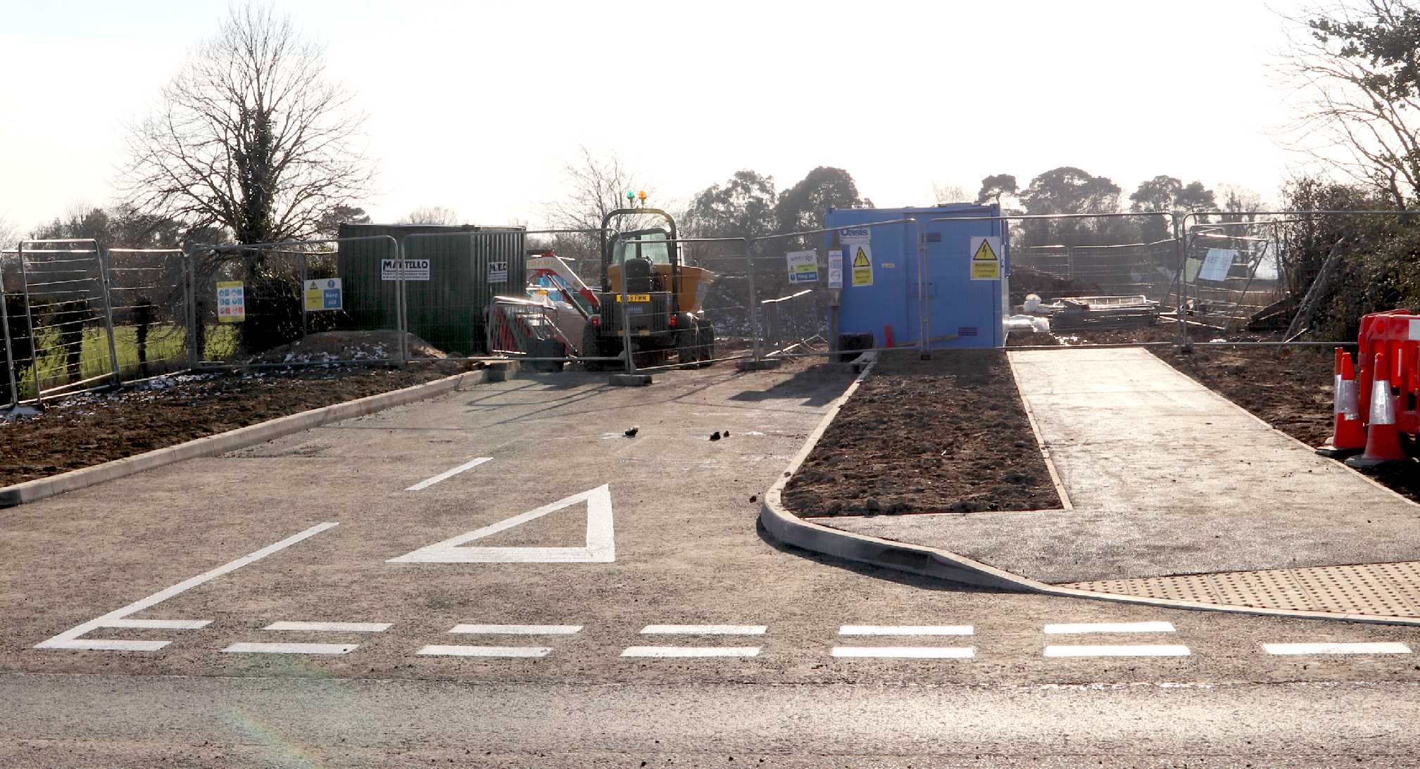
CORPORATE MANSLAUGHTER - Thought by many to be the most dangerous junction leading to a blind hill. What were East Sussex Highways thinking of in approving this tiny entrance, devoid of a suitable visibility play, in the process putting so many local residents and through traffic at risk. Locals are calling this stretch of road Death Hill, and we agree with that sentiment. It is an accident waiting to happen in our view. This is the entrance to Shit Avenue, as the locals are referring to it, under construction by Westridge.
Imagine that it is school run time, you are late and there is a car behind you hooting. The road ahead is barely visible with a mist, but it looks clear to make a right turn onto the A271. Then over the brow of the hill to the left, fast moving traffic appears, the drivers going a little too fast up the hill because of being delayed in the usual village snarl up. They do not see your car where your vehicle is grey and sprayed with road dirt. They drive straight into the side of your vehicle.
Who is responsible?
ESCC Highways were responsible for ensuring that the visibility splay would be adequate in all circumstances.
The developers are responsible and equally guilty due to the Accessories and Abettors Act, and so is Wealden, their officers and councillors, for granting permission. Even the Parish councillors are part to blame, for not opposing such proposals, when any ordinary person would think to be risky at best. All of these actors owed the drivers of vehicles on the A271, and those seeking to use this junction as access, a duty of care, as per Wednesbury Rule principles of law.
Either way, with ESCC and WDC being corporations, the same as Latimer Homes and Westridge Construction, we are looking at a charge of corporate manslaughter, the same as with Railtrack plc and Grenfell Towers. It matters not that Westridge Construction undertook the work, they will not bear the brunt of any prosecution or litigation alone, but will stand accused the same as Latimer Developments and Clarion Group, and all the council officials in the chain. Especially, concerning the complete lack of entries in the Registers of the Parish and District councils, allegedly.
CONTACT YOUR MP OR COUNCILLOR - Concerning the potential for manslaughter charges in the case of accidents at this recently identified danger area, you might want to write to the MPs or Councillors responsible for allowing the development, to avoid a Grenfell Tower legal situation where potential homeowners may be unable to sell property in the future. In 2015, James Brokenshire was asked to call in the application that led to this deficient visibility splay - and dangerously confused placing between the brow of a hill and speed signs - but he refused. We wonder if that refusal constitutes "joint enterprise" should there be a fatality.
CAUSING DEATH BY DANGEROUS DRIVING - We imagine that a valid defence in this case would be that the visibility splay leading to Death Hill was inadequate, laying the blame at the foot of those involved in the development chain. Compensation might be claimed against injury or loss of any children that may be consequential upon failure of Highways to secure safety measures to the requisite standard. Pain and suffering relating to the parents anguish at the death of their loved ones, or the loss of any adult might be claimed and confiscation orders made against the developer and/or the council in any case involving corporate manslaughter. This brings to mind the Wednesbury (Corporation) case that established the Rule of Reasonableness in making Judicial Review applications.
WD/2015/0090/ HERSTMONCEUX LIME CROSS CONDITIONS
SUICIDE JUNCTION - This is the section of road known locally as Shit Avenue, leading onto the busy A271 at Death Hill. Shit Avenue leads into Pooh Park. In the distance you can see the trees bounding Lime Park, where the houses (if) built on the feed slope leading to Lime Well, will more than likely poison the historic drinking water, potentially making all in the chain leading to such contamination liable by way of common purpose (civil damages) and/or joint enterprise during prosecutions under extant environmental statute.
HIGHWAYS - EAST SUSSEX COUNTY COUNCIL
The stretch or road fronting the site is subject to a 30mph speed limit; however a speed survey has been undertaken close to the proposed access point in order to determine actual vehicle speeds. The results of this survey indicate an 85th % tile vehicle speeds of 40.6mph for vehicles approaching the site access from the north-west and 44.9mph for those approaching from the south-east.
Although
the sightlines shown on the submitted plan fall short of the requirements based on my own calculations I am satisfied that appropriate visibility splays can be provided either side of the site access.
NPPF - NATIONAL PLANNING POLICY FRAMEWORK A - Z INDEX
WD/2015/0090/MAO HERSTMONCEUX VILLAGE 70 HOUSES CONDITIONS A - Z INDEX
LINKS & REFERENCE
https:/
WHAT'S BROWN AND SMELLS OF SHIT? - That's right, decisions like granting permission for an access that clearly poses a danger to users of the A271 and those seeking to join the traffic flow during rush hour.
Please use our A-Z INDEX to navigate this site
|
|
|
|